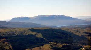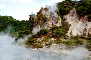
One of the more impressive areas I visited while in New Zealand was the Waimangu Valley near Mt. Tarawera (above). The valley itself was created by blast explosions (phreatic explosions) during the 1886 eruption of Mt. Tarawera. These eruptions cut right down the axis of the rhyolite domes (most of which erupted ~1305 A.D.) and extended off the volcanic edifice to form the valley to the west of the volcano. In the valley, no juvenile lava was erupted, instead explosions carved out large pits that formed the Waimangu Valley and today the valley is filled with lakes and thermal features (below).

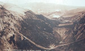
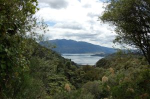
The 1886 eruption at Tarawera was not large by any means, erupting only ~0.7 cubic kilometers of basalt (compare that with the 1305 Kaharoa Rhyolite from Tarawera that erupted 5 cubic kilometers). However, hundreds of Maori villagers died during the eruption and basaltic tephra can be found all over the area north of Tarawera into the Bay of Plenty. Yet, only about a century later, most of the destruction caused by the eruption has been erased by vegetation. Compare the photo of the valley just after the eruption (top) to the one I took in January of 2009 (bottom) to see how things have recovered.

Waimangu Valley, 1886

Waimangu Valley, 2009
Volcanoes are truly destructive, but still just a flash in the pan for most earth processes.
Category Archives: Hot springs
Yellowstone New Year’s Eve Update

Yellowstone looks to be keeping everyone on their toes as we ring in 2009. The earthquake swarm reported earlier this week is continuing, with multiple events between 2-3.5 on the Richter Scale. Again, the folks monitoring the caldera – this time the Univ. of Utah – play down these events as normal for any active caldera system … and they’re very likely right. However, the media love to bring up the “supervolcano” angle and we’re even getting expert opinion from (wait for it) Garrison Keillor!. The earthquakes are just normal earthquakes so far – none of the dreaded/anticipated harmonic tremor that might indicate an eruption. This will likely mean that more gas and water monitoring will be occurring in the park in the coming weeks/months.
Signs of activity near Mt. Kurikoma, Japan?

I am always amazed by the number of volcanoes that show signs of activity every year that I have never heard of before. Case in point is this report of activity near Mr. Kurikoma, on the island of Honshu in Japan. The last known eruptions at Kurikoma were back in 1950, and they seem to be water-magma interactions that produce phreatic explosions – and even beyond this 1950 eruption, there isn’t much information about the eruptive history at Kurikoma.
However, if you look at the report, the activity is actually rather far from the summit of Kurikoma – a full 7 km to the southwest. There are areas of hot springs near the volcano, and this very well could be a sign that some increased amount of volcanic gases are making it to the surface. Now, whether this means that any type of eruption might happen is purely speculative, but Dr. Ueki Tohuku University indicates he doesn’t think it is directly related to Korikuma volcano itself. Just another place to keep an eye on to see where it all leads.